Foss walk from Sheriff Hutton (7 miles): Castles, cricket fields and countryside
5 min read
Yorkshire’s Howardian Hills are a patchwork of history and hidden paths, where ruined strongholds rise above quiet farmland and the River Foss meanders past cricket greens and wildflower meadows. On a summer’s evening here, outdoor adventurers, photographers and Times columnist writers Jen and Sim Benson set aside their long-distance instincts to enjoy a shorter wander, discovering wildlife encounters, golden fields and the timeless charm of the Foss Walk.
Walk: Foss Walk from Sheriff Hutton, North Yorkshire
Start/finish: The Finkle Street – Main Street crossroads, Sheriff Hutton
Distance: 7 miles / 11.3km.
Challenge level: Easy
Detailed directions below.
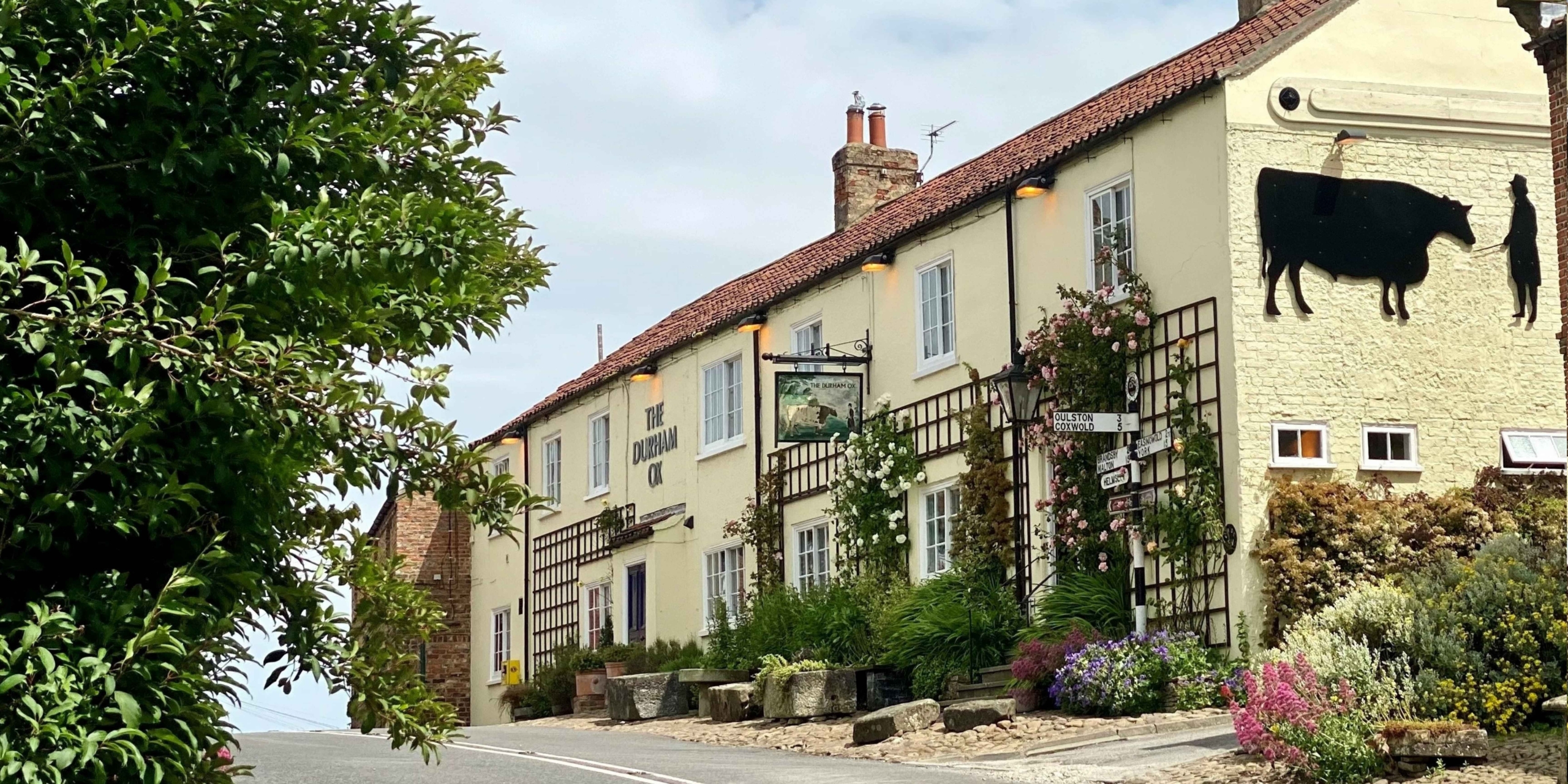
The Durham Ox in Crayke stands on the edge of the gloriously undiscovered Howardian Hills, a North Yorkshire National Landscape covering 79 square miles of limestone ridges, pastures and woodlands. Unscathed by the Industrial Revolution and little built-on since, it’s an area rich in historical and archaeological interest. Old priories and castles stand alongside vast swathes of parkland including the Hovingham and Castle Howard estates. With the OS Map spread out on the table in our comfy quarters behind the pub, we traced an extensive spider’s web of footpaths and bridleways through the hills and made it our mission to explore as many as possible.
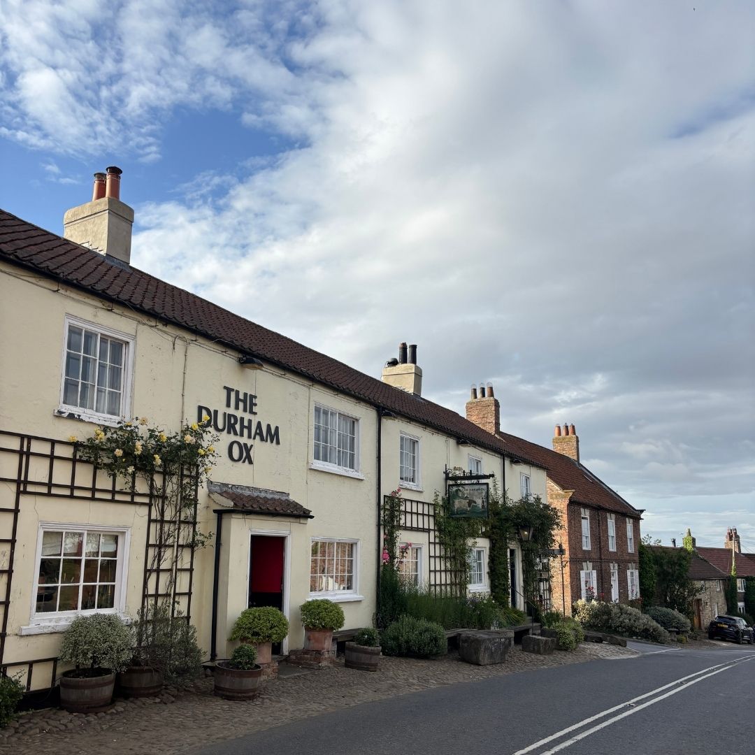
One of our favourite discoveries was the Foss Walk, which passes through Crayke on its 28-mile (45km) route along the course of the River Foss from its confluence with the Ouse in York to its source at Pond Head close to Easingwold. After enjoying the excellent Early Doors menu at the Ox (last orders by 6.45pm) we decided to make the most of the warm summer evening, heading out to explore the walk to the east of the village.
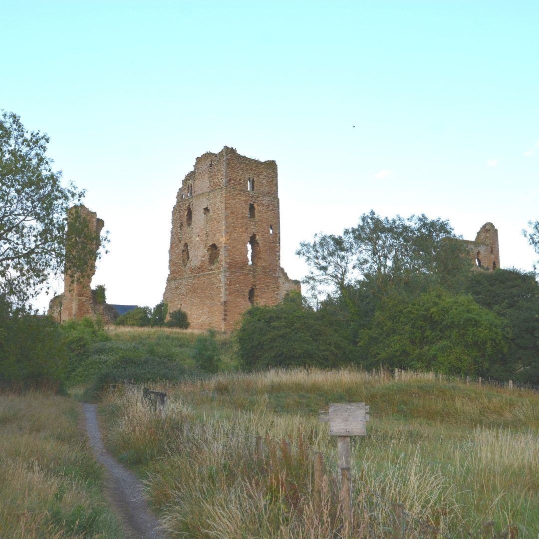
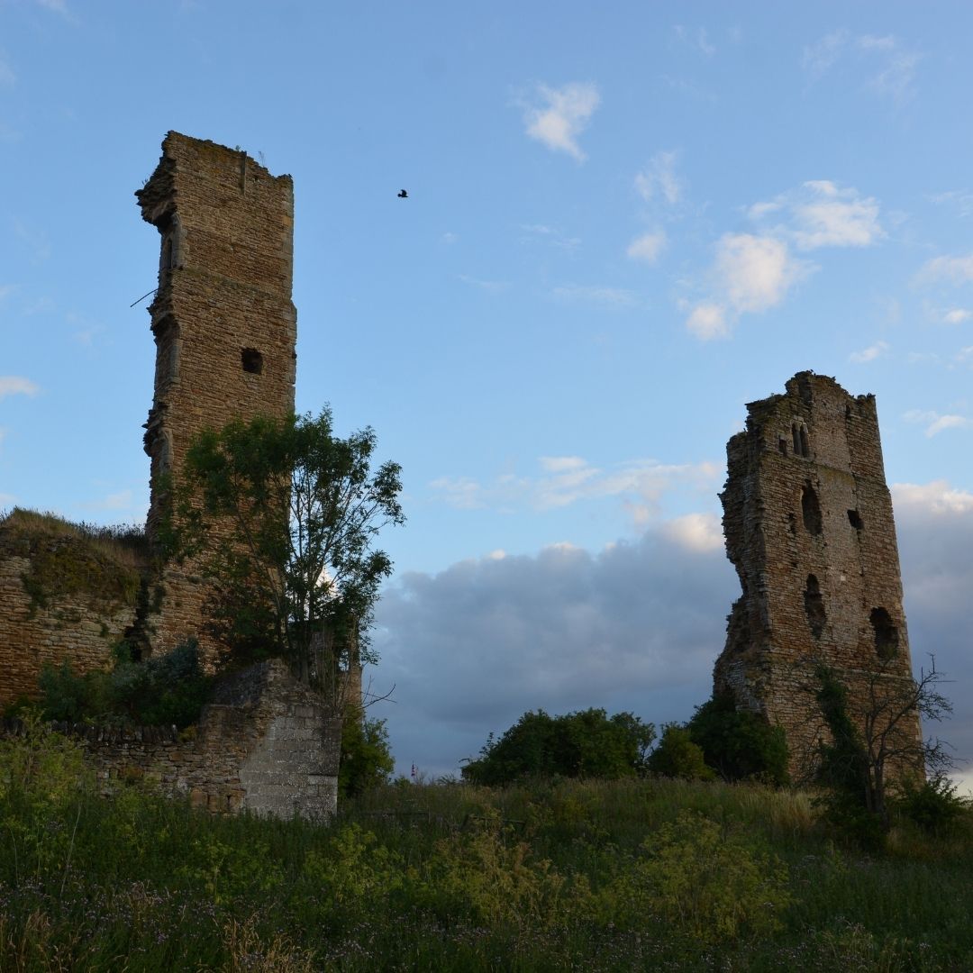
We picked up the Foss Walk at Sheriff Hutton, where the vast ruins of a former quadrangular castle dwarf the surrounding buildings. Built in the late 14th century on the site of a 12th-century motte and bailey structure, the design is credited to John Llewyn who also built nearby Bolton Castle. While it’s not open to the public, a footpath loops the ruins allowing visitors to appreciate its epic scale.
The route took us south on a quiet lane, low sun slanting long shadows across a vast landscape of tree-lined farmland. Turning onto a footpath through fields of sheep-cropped grass, the thwacks and shouts of a nearby cricket match drifted through the still air. This stretch of the trail to West Lilling is also the Centenary Way, built to commemorate 100 years of the North Yorkshire County Council, and the Ebor Way, which runs south from Helmsley through York and over Ilkley Moor to Wharfedale.
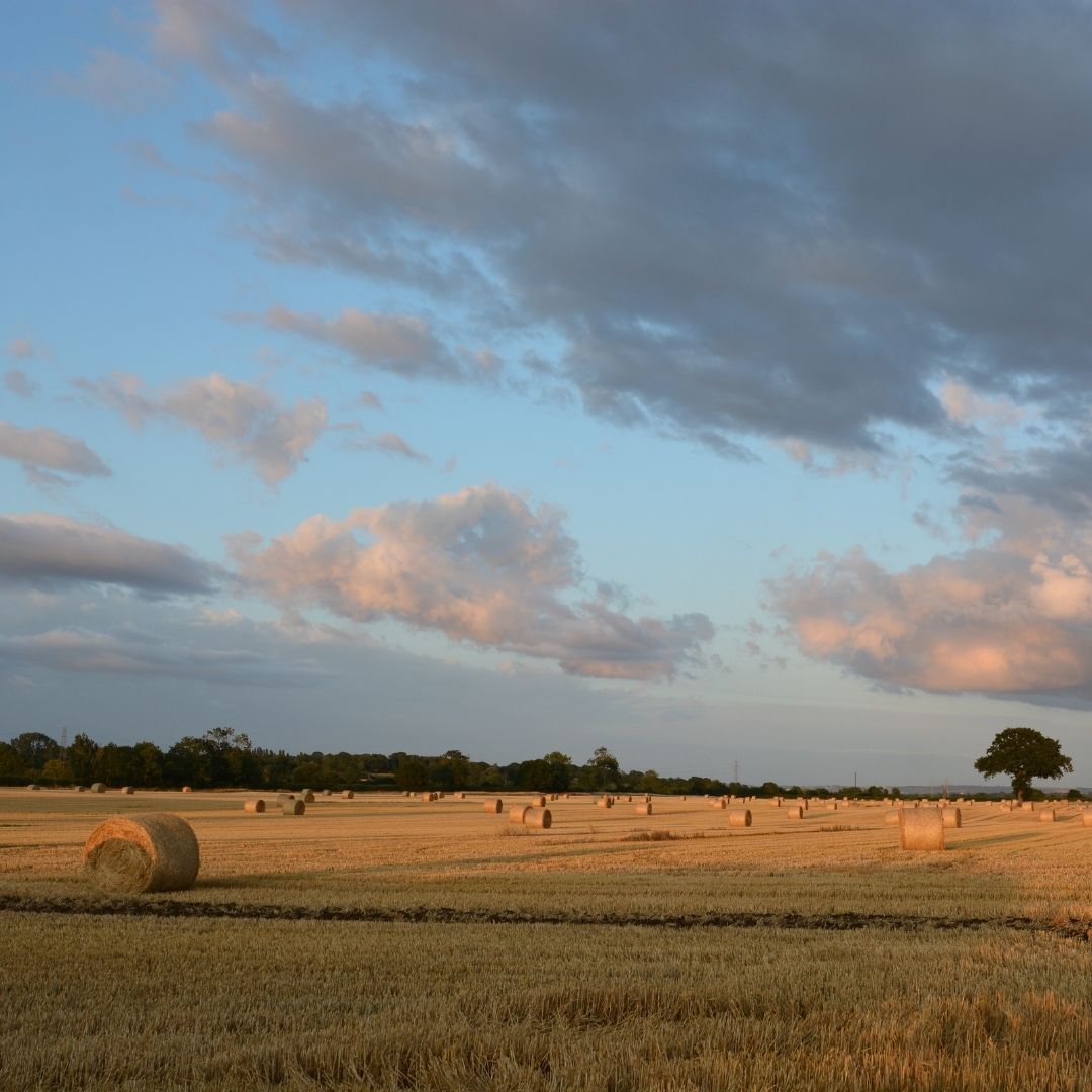
Joining New Lane out of West Lilling the setting sun blazed across the sky, kindling rippling fields of ripening wheat and oats. Hares bolted from the margins, vanishing into the depths of the crops; roe deer watched us warily; a lone red kite scribed wide circles above.
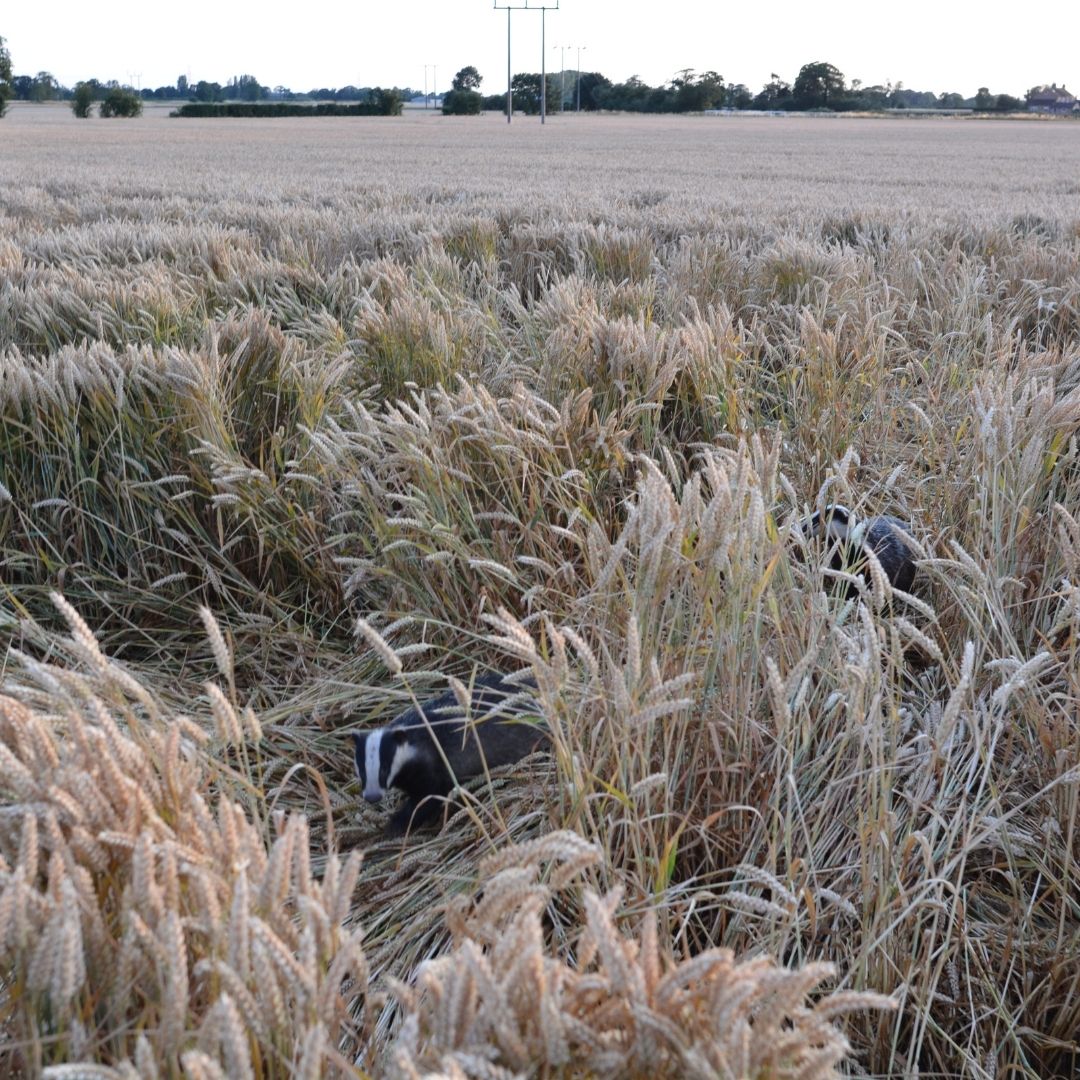
Another cricket match was in full swing at Sheriff Hutton Bridge and we watched an over from the riverside path, the day’s last meadow browns flitting between high summer grasses. Turning onto a track after Cornborough Farm we could hear strange trampling sounds coming from the adjoining wheat field. A stripy face appeared between stalks, then, a moment later, a whole family of badgers emerged. We stood entranced for a long time, watching them play. Eventually they disappeared across the fields, and we ambled the last mile of our walk, picking fat, ripe blackberries from the hedgerows.
Directions
- Follow Main Street, turn right onto footpath, then right again walking past castle to Finkle Street.
- Turn left, follow road to left onto Foss Walk, continuing alongside cricket pitch and over several stiles and fields to road in West Lilling.
- Turn left onto Goose Track Lane then right onto New Lane. Continue to crossroads, turning right to follow Lilling Low Lane to Sheriff Hutton Road.
- Follow Sheriff Hutton Road left, over bridge and then right onto footpath. Continue on the path through fields, with the River Foss on right, to reach a track.
- Follow the track and Foss Walk right, passing Foss House. Take the next left and then first left past Cornborough Farm.
- Turn right through a gate and follow the Foss Walk across a couple of fields to a track junction.
- Turn right, following the track and hedge line alongside fields to a lane by Cornborough Manor.
- Follow the lane right, around a sharp left-hand bend to a gate on the right.
- Go through the gate and follow the Foss Walk across three fields to a path junction.
- Turn right, leaving the Foss Walk and following the footpath along the edge of a field.
- Take the next left over a small bridge through the hedge. Follow the path around the next field and right to re-join the Foss Walk.
- Turn right and follow the Foss Walk into Sherrif Hutton to finish.
Be the first to discover our newest places, and receive travel tips from our team of experts.
Sign up >Feeling inspired? Explore all our places to stay in Yorkshire >

Jen & Sim Benson
Jen & Sim Benson are outdoor adventure writers and photographers with a passion for wild places. They’ve authored 12 books including The Adventurer’s Guide to Britain (Bloomsbury), Great British Walkies (National Trust Books), Wild Running (Wild Things), 100 Great Walks with Kids (Bloomsbury) and the forthcoming Classic Country Walks (National Trust Books). Regular contributors to Runner’s World, Trail and Walk magazines, they write a weekly column – A Good Walk – for The Times Weekend. @jenandsim (Instagram), jenandsimbenson.co.uk.
You might also like
UK towns and villages perfect for autumn and winter escapes

Beth Tingle
5 min read

Pasture, pizza and back to the pub: Askham Fell and Lowther Estate walk
Jen & Sim Benson
5 min read

Royal security, mismatched columns and water sounds: The making of a country garden

Ruth Richardson
Sawday's Expert
5 min read